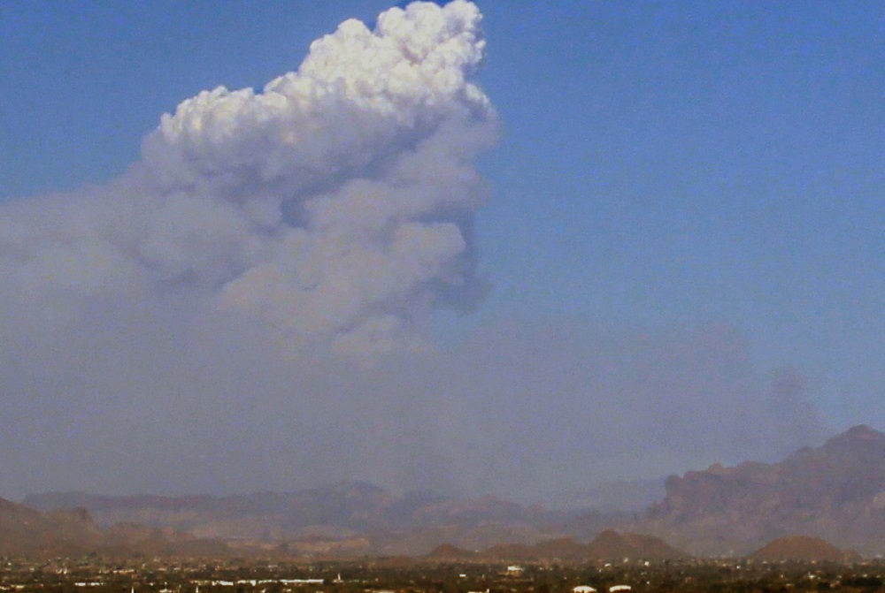
The human-caused Woodbury fire has been burning east of the Phoenix valley since June 8th. During the heat of the day, when relative humidity is the lowest, the fire becomes very active with a noticeable smoke column seen from across the Valley. At times, it may have looked like a thunderstorm was forming at the top of the smoke column. Your eyes are not tricking you; this is called a pyrocumulus.
Let's start with the word itself. "Pyro" is Greek for fire and "cumulus" is Latin for heap (think puffy heap "cumulus clouds"). Put them together, and you get "fire cloud" or pyrocumulus. These types of clouds are also a clear sign that the fire is creating its own weather. So, how do they form?
There are several things to remember when looking at the formation of pyrocumulus. First, a large percentage of what makes up smoke is water vapor. Second, for condensation to form, it needs a condensation nuclei for liquid water to form on. Third, smoke is also made up of tiny particles that are 2.5 microns or less in size. To put this size into scale, a human hair is about 50 microns in diameter, so smoke particles (PM-2.5) are about 20 times smaller than a human hair and make perfect condensation nuclei. And finally, fire is extremely hot. According to the Natural Resources Canada, the average wildfire burns at around 1,400ºF, with an intense fire exceeding 2,000ºF.
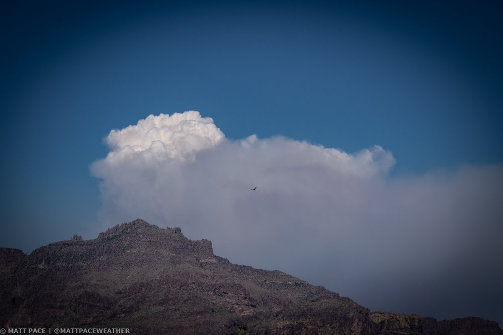 A pyrocumulus begins to form when a fire becomes active and produces extremely hot air and smoke. The hot air and smoke begin to quickly rise into the atmosphere, which is also called an updraft. This updraft is the same as you would see with any thunderstorm; however, it is much stronger given the heat from the fire. As the updraft rapidly forces air up, condensation occurs due to all the water vapor in the smoke and the millions of condensation nuclei present. Once all of this comes together, you will visually see the pyrocumulus cloud rise above the fire, reaching heights at times of over 30,000 feet.
These pyrocumulus clouds can also indicate extremely dangerous weather conditions on the ground. As air rapidly rises above the fire into the updraft, the air at the surface has to be replaced. Since air is not coming out of the ground, it has to come in from the side, producing strong and often erratic winds, that only act to increase the intensity of the fire.
Pyrocumulus can get big enough to become full-fledged thunderstorms with all the same threats: lightning, downbursts and rain. The two biggest threats are (1) lightning, which can create new fires and (2) downburst winds that can cause 50+mph winds over the fire.